Welcome | New | Cemeteries | Query | Photos | Probate | Town Index | Links | Lookups | Search
 |
|

|
DARIEN Fron The Connecticut Guide: What to See and Where to Find It 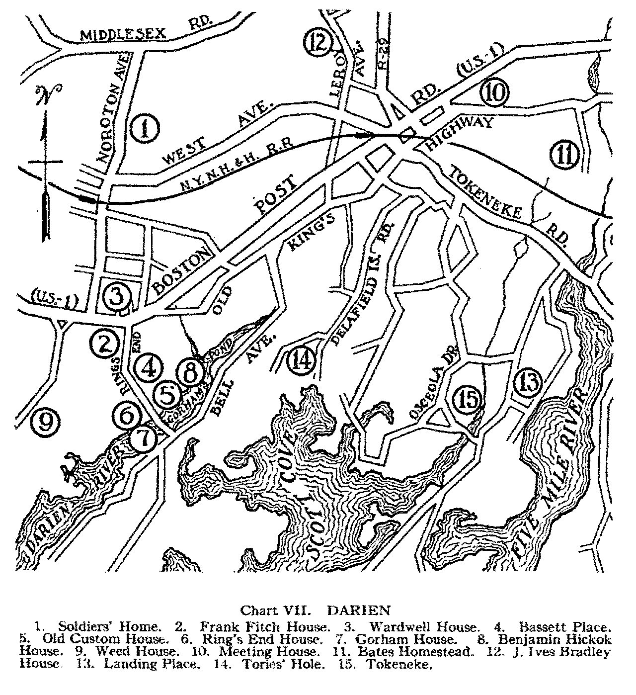 Chart VII of Darien. For a full view click here
Darien
Darien, formerly a part of Stamford, was settled in 1641 or soon after, and organized as the parish of Middlesex in 1737. In 1820 it was incorporated as a separate town, and named through some sailor's fancy from the Isthmus of Darien. The settlement was a busy port of entry in the sailing ship era. At Noroton, on the west of the town, is the Soldiers' Home (Noroton ave: 1 on Chart VII) given to the State in 1854 by Benjamin Fitch, who had used his farm during the Civil War as a home for soldiers' orphans. Among the old houses in this section are the Frank Fitch House (2) 1756, and the Wardwell House (3) of about the same date, both on Post Road. Turning south on Ring's End Rd., we find a number of other landmarks. To our left is the Bassett Place (4: Guild House) built about 1690 and moved down from Stratford. On our right is the Old Custom House (5) a small white building with porches. Farther, on the waterfront, Ring's End House (6) about 1750, was used by ships' officers while their cargo was unloading; the timbers were hewn by ship builders, and the stairs built on the outside and later covered with a roof. Beside the house is a pile of cobble stones brought from England as ballast. Gorham's mill was served by a dam at this point, and one of the old millstones forms part of the path in the yard. The present Gorham House (7) on our left, with the date 1789 in the chimney, has good ironwork, some of it brought direct from England. Overlooking Gorham Pond stands another migrant, built at Southbury in 1730 by Col. Benjamin Hickok (8: Swift House.) A little to the west, near Water Lane, the Weed House (9) with white shingles dates from 1749. There is an excellent view from Long Neck Point to the southwest. At Darien proper is the dignified brick Meeting House (10: Post Rd. at Brookside ave.) near the site of the original church, where in 1781 Rev. Moses Mather and the men of his congregation were surprised during service by a company of British soldiers, largely made up of Tory refugees. They were carried to New York, where several of them died in a prison ship. A tablet on the church building commemorates this episode. The Bates Homestead (11: Raymond st., south of the old King's Highway) a large yellow house, has the date 1749 on the stepping stones in the walk. The old J. Ives Bradley House (12: Hale House; Le Roy ave.) was built in 1743 and brought down bodily from Durham. In the northeast corner of the town is the Mather Homestead (Brookside and Grand View ave.'s) dating from 1778. At Rowayton, to the southeast, we find old Landing Place (13; West Side rd.) on Five Mile River, where ships docked alongside the rock ledge at high tide. On Contentment Island, west of the rivermouth, is the Williamson House, built about 1700 by a sailor who quit the sea and married an Indian girl. The island is the site of an old Indian village, and near the house is a pothole in the rock used for grinding corn. Tories' Hole (14) a cave with Revolutionary traditions, lies between Delafield Islands and Tory Hill Rds.: the entrance was blocked by blasting a few years ago. The residential district of Tokeneke has many beautiful gardens laid out in the English and Italian styles. Source: The Connecticut Guide: What to See and Where to Find It, A Project of the State Planning Board, Initiated under CWA and completed with FERA funds. Compliled by Edgar L. Heermance and published by The Emergency Relief Commission, Hartford, CT, 1935. |